


2931336 - REEVES Voting District, Upson County, Georgia
About
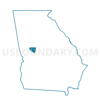
Outline

Summary
| Unique Area Identifier | 563022 |
| Name | 2931336 - REEVES Voting District |
| County | Upson County |
| State | Georgia |
| Area (square miles) | 54.25 |
| Land Area (square miles) | 53.43 |
| Water Area (square miles) | 0.82 |
| % of Land Area | 98.49 |
| % of Water Area | 1.51 |
| Latitude of the Internal Point | 32.91752860 |
| Longtitude of the Internal Point | -84.46335800 |
Maps


Graphs
Select a template below for downloading or customizing gragh for 2931336 - REEVES Voting District, Upson County, Georgia


Neighbors
Neighoring Voting District (by Name) Neighboring Voting District on the Map
- 19901 - CHALYBEATE Voting District, Meriwether County, GA
- 19910 - LOWER 9TH-WOODB Voting District, Meriwether County, GA
- 19914 - COVE Voting District, Meriwether County, GA
- 2314 - MOLENA Voting District, Pike County, GA
- 26302 - VALLEY Voting District, Talbot County, GA
- 2931610 - ATWATER Voting District, Upson County, GA
- 2935610 - TOWN Voting District, Upson County, GA
Top 10 Neighboring County Subdivision (by Population) Neighboring County Subdivision on the Map
- Thomaston CCD, Upson County, GA (19,225)
- Manchester CCD, Meriwether County, GA (6,214)
- Concord-Molena CCD, Pike County, GA (3,878)
- Sunset Village CCD, Upson County, GA (3,526)
- Woodland CCD, Talbot County, GA (2,773)
- Woodbury CCD, Meriwether County, GA (2,061)
Top 10 Neighboring Place (by Population) Neighboring Place on the Map
Top 10 Neighboring Unified School District (by Population) Neighboring Unified School District on the Map
- Upson County School District, GA (27,153)
- Meriwether County School District, GA (21,992)
- Pike County School District, GA (17,869)
- Talbot County School District, GA (6,865)
Top 10 Neighboring State Legislative District Lower Chamber (by Population) Neighboring State Legislative District Lower Chamber on the Map
- State House District 127, GA (50,054)
- State House District 135, GA (48,898)
- State House District 128, GA (46,413)
Top 10 Neighboring State Legislative District Upper Chamber (by Population) Neighboring State Legislative District Upper Chamber on the Map
- State Senate District 29, GA (173,136)
- State Senate District 16, GA (165,379)
- State Senate District 14, GA (158,067)
Top 10 Neighboring 111th Congressional District (by Population) Neighboring 111th Congressional District on the Map
Top 10 Neighboring Census Tract (by Population) Neighboring Census Tract on the Map
- Census Tract 9705, Meriwether County, GA (6,214)
- Census Tract 9708, Meriwether County, GA (5,015)
- Census Tract 103, Pike County, GA (3,878)
- Census Tract 103, Upson County, GA (3,526)
- Census Tract 102.02, Upson County, GA (2,969)
- Census Tract 9601, Talbot County, GA (2,773)